
Good day, Dear Visitor
LLC “Scientific and Production Enterprise “SKY EYE”
Science • Innovations • Digital Technologies • Environmental Monitoring
LLC “SPE “SKY EYE” is a research and production enterprise that combines scientific expertise and practical technological solutions in the field of soil research, environmental monitoring, digital technologies and land resource restoration.
We carry out scientific research, conduct field and laboratory surveys, work with spatial and remote data, develop automated monitoring systems and participate in international scientific cooperation.
Our key competencies
Soil and Land Resource Research
Soil surveys, assessment of their condition, research of physical and agrochemical properties, study of degradation and pollution processes.
GIS and Remote Monitoring
Geoinformation analysis, mapping, use of satellite data and aerial photography for studying the state of soil cover and land resources.
Digital Soil Monitoring
Automated collection and analysis of data on soil parameters, development and use of sensor systems and digital monitoring platforms.
Thermal and Hydrothermal Monitoring
Research of temperature regime, moisture content and other hydrothermal characteristics of soils, as well as their spatial and seasonal dynamics.
Restoration and Monitoring of Degraded Lands
Scientific substantiation of approaches to assessing the condition, restoration and further monitoring of degraded and damaged lands.
Team
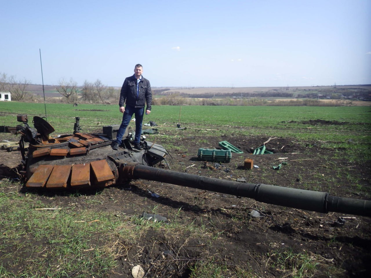
Maksym Solokha
Team Leader, Doctor of Agricultural Sciences
Specialist in the field of soil science, digital land monitoring and geoinformation technologies.
Key competencies:
- soil research and surveys;
- GIS and spatial analysis;
- Earth remote sensing;
- satellite monitoring;
- aerial photography using UAVs;
- soil and land resource mapping;
- assessment of land degradation and pollution;
- field and laboratory soil research.
Team competencies
Specialists are involved in project implementation according to their thematic focus and required competencies.
Main areas of the team’s expertise:
- thermal and hydrothermal soil monitoring;
- research of soil temperature regime and moisture content;
- automated sensor monitoring systems;
- digital data collection, transmission, storage and analysis;
- embedded systems programming and IoT solutions;
- software development for monitoring systems;
- database and web platform creation;
- big data analysis and mathematical modelling;
- development of data processing algorithms and decision support systems;
- geoinformation analysis and spatial modelling;
- Earth remote sensing and satellite data processing;
- statistical analysis and data visualisation;
- assessment of soil condition, degradation and restoration;
- monitoring of lands damaged as a result of military actions;
- preparation of scientific and analytical materials.
Scientific and innovation activities
We combine field research, laboratory analysis, GIS and remote sensing, sensor technologies and digital data analysis to solve applied tasks in the field of soil research and monitoring.
Our scientific interests cover: soil resources • soil pollution • digital monitoring • thermal and hydrothermal soil regime • remote sensing • GIS • land restoration
International cooperation
LLC “SPE “SKY EYE” develops international scientific partnership and is interested in cooperation with scientific institutions, universities, research organisations and innovative companies.
We are open to participation in joint research and innovation projects, in particular within the framework of Horizon Europe and other international programmes.
Our potential areas of cooperation:
- soil research and monitoring;
- digital technologies and sensor systems;
- GIS and remote sensing;
- assessment of land degradation and pollution;
- restoration of damaged and degraded territories;
- creation of automated environmental monitoring systems;
- development and testing of innovative technologies.
We are open to international research and innovation collaboration.
Scientific publications and public activity
The results of our research are presented in scientific publications, conference materials and professional journals. The activities of our specialists are also featured in the media and professional information resources.
1. International publications & articles with DOI
- Estimation of the content of trace metals in Ukrainian military-affected soils // Notulae Botanicae Horti Agrobotanici Cluj-Napoca, Vol. 53(1), 2025. DOI: 10.15835/nbha53114328
- Soil Degradation and Contamination Due to Armed Conflict in Ukraine // Land, 13, 1614, 2024. DOI: 10.3390/land13101614
- Methodological and practical aspects of using satellite imagery to assess the military impact on soils // Scientific Horizons, 27(12), 2024. DOI: 10.48077/scihor12.2024.56
- Ecological assessment of heavy metal content in Ukrainian soils // Journal of Ecological Engineering. DOI: 10.12911/22998993/192669
- Russian-Ukrainian war impacts on the environment. Evidence from the field on soil properties and remote sensing // Science of the Total Environment.
- Approximation of data determined by the sedimentation method according to DSTU ISO 11277:2005 and the laser diffraction method // Agricultural Sciences, Iss. 2 (47), 2025. DOI: 10.37406/2706-9052-2025-2.3
- Methodological principles of mapping the consequences of military soil degradation at the level of territorial communities // Ukrainian Geographical Journal, No. 4, 2024. DOI: 10.15407/ugz2024.04.022
- Identifiers of the impact of hostilities on the soil cover using satellite data, 2024. DOI: 10.32782/2226-0099.2024.137.29
- Scientific and methodological foundations of remote agroecological monitoring and forecasting // Bulletin of Agricultural Science, No. 4 (829), 2022. DOI: 10.31073/agrovisnyk202204-08
- Current state of methodological approaches to determining soil particle size distribution in the world // Agrarian Innovations, No. 8, 2021. DOI: 10.32848/agrar.innov.2021.8.12
- Assessment of the impact of war on chernozems as a prerequisite for restoring their fertility // Agroportal.
- Methodological approach to processing aerial photographs based on aerial photography // Tavria Scientific Bulletin, Iss. 110(1), 2019.
2. Scientific monographs & books
- Satellite monitoring of erosion-degraded agricultural landscapes // Kyiv: Agrarna Nauka, 2024. DOI: 10.31073/978-966-540-605-1
- Conceptual approaches to the restoration of soils damaged by the armed aggression: monograph // Kyiv: Agrarna Nauka, 2024. DOI: 10.31073/978-966-540-604-4
- State and tasks of scientific support for soil resource management at the stage of armed aggression and post-war reconstruction // Kyiv: Agrarna Nauka, 2023. DOI: 10.31073/978-966-540-590-0
- Land Use and Protection Programme (soil and agrochemical aspects) // Kyiv: Agrarna Nauka, 2023. DOI: 10.31073/978-966-540-594-8
- Settings of the laser diffractometer and preparation of a soil sample for analysis… // In the monograph “Formation of a new paradigm of agricultural sector development in the 21st century”. Lviv–Torun: Liha-Pres, 2021. DOI: 10.36059/978-966-397-240-4-19
3. Patents (innovative activity)
- Method of aerial photography for qualitative assessment of vegetation by nitrogen (Patent No. 102162 Ukraine, 2015).
- Unmanned aerial vehicle (Invention Patent No. 99171 Ukraine, Bull. No. 14, 2012).
- Method of determining the state of soils and agricultural crops using aerial photographs of the soil surface (Patent No. 70307 Ukraine, Bull. No. 11, 2012).
4. English-language publications in international collections
- Diagnostics of the erosion state of arable lands using drone and verification… // International Food, Agriculture and Veterinary Sciences Congress (Türkiye), 2023.
- The use of aerial photography data and instrumental data in adaptive farming // Scientific Papers. Series E, Vol. IX, 2020.
- Identification of agri-field contours by UAV of aero-photography techniques // Book of Abstracts. Section 1. Agronomy, 2018.
- Environmental aspects of land monitoring from aerial photos // Materials of the IX International Conference “Quality Strategy in Industry and Education” (Varna), 2013.
5. Selected scientific publications (grouped by editions)
Journal “Tavria Scientific Bulletin”
- Determination of nitrogen rates based on aerial photography (Iss. 109, 2019).
- Detection of salinisation spots based on aerial photography (Iss. 108, 2019).
- Monitoring of soil contours of forest vegetation based on aerial photography (Iss. 107, 2019).
- Problems of agricultural vegetation identification based on aerial photography (Iss. 91, 2015).
- Methodological approaches to creating an orthophotomap based on aerial photography for soil cover mapping (Iss. 87, 2014).
- Features of constructing soil map schemes in GIS MapInfo (Iss. 86, 2013).
- Determination of winter wheat nitrogen supply using aerial photography (Iss. 84, 2013).
- Application of the Vertical Mapper (MapInfo) interpolation method in solving cartographic problems of soil science (Iss. 75, 2011).
- Aerial photography from a remotely piloted aerial vehicle (RPAV) as the basis of precision farming (Iss. 71, 2010).
- Technical problems in GIS mapping (Iss. 52, 2007).
Journal “Bulletin of Agricultural Science”
- Monitoring of illegal dumps and soils based on aerial photography (No. 09, 2019).
- Aerial monitoring of the state of fruit plantations (Iss. 10, 2013).
- Monitoring of field unevenness based on aerial photography from an RPAV (Iss. 6(698), 2011).
- Assessment of the current ecological and agro-reclamation state of the lands of the Inhulets irrigation system (Iss. 4(50), 2011).
Journal “Agrarian Innovations”
- Variability of geochemical and granulometric composition of soils in the Forest-Steppe of Ukraine under the influence of hostilities (No. 14, 2022).
- Methodological and technical aspects of determining the granulometric composition of sandy soil samples… (No. 13, 2022).
Bulletin of V.V. Dokuchaev KhNAU (Soil Science Series)
- Use of drones for identifying erosion processes (No. 2, 2019).
- Classification of agricultural crops based on aerial photography (No. 1, 2019).
- Phytocultivation of floodplain soils in the aspect of improving their ecological stability (No. 1, 2015).
- Dynamics of spectral brightness of soft wheat crops based on small-scale aerial photography (No. 2, 2013).
- Managerial decision-making in solving soil science problems using RPAVs (No. 1, 2013).
- Analysis of the state of irrigated lands… (No. 4, 2010).
- Problems and prospects of soil aerial monitoring (No. 3, 2009).
- Methodological approaches to the consolidated assessment of the soil-reclamation state of irrigated lands (No. 2, 2009).
Specialised ecological publications (KhNU Bulletin, “Man and Environment”)
- Use of drones in solving ecological problems (KhNU Bulletin, Ecology Series, No. 1070, Iss. 9, 2013).
- Methodology for assessing the impact of illegal dumps on the ecological state (KhNU Bulletin, Ecology Series, No. 944, Iss. 6, 2011).
- Air monitoring system near high ecological risk facilities… (Man and Environment, Iss. 2(15), 2010).
Professional publications “Land Management Herald” & “Water Management of Ukraine”
- Monitoring of forest resources using RPAVs… (Land Management Herald, No. 5, 2012).
- Creation of interactive maps as a methodological approach to disseminating environmental information (Land Management Herald, No. 2, 2012).
- Construction of a 3D surface (relief) image in Vertical Mapper 3.1 (Land Management Herald, No. 11, 2011).
- Monitoring the ecological and agro-reclamation state of lands of the Inhulets irrigation system… (Water Management of Ukraine, Iss. 4, 2011).
Specialised industry publications
- Equipment for rapid soil analysis… (Propozytsiia, Iss. 11, 2018).
- Use of robots in processing agricultural crops… (Propozytsiia, Iss. 4, 2016).
- Overview of radio communication means for agricultural enterprises (Propozytsiia, Iss. 3, 2016).
- Methodological “abyss” in the use of unmanned aerial vehicles… (Zerno, 2016).
- Problems of identifying agricultural vegetation… (Propozytsiia, Iss. 2, 2015).
- Database – a manager’s assistant (Propozytsiia, Iss. 11, 2014).
- The Internet helps with what it can (Propozytsiia, Iss. 9 & 10, 2014).
- What kind of “space” does agrarian Ukraine need? (Propozytsiia, Iss. 7, 2014).
- View from the sky, or soil contours from a drone’s wing (Propozytsiia, Iss. 3, 2014).
- Relief model – from a drone’s board (Propozytsiia, Iss. 2, 2014).
- Use of drones in precision farming (Propozytsiia, Iss. 1, 2014).
- Problems and prospects of aerial monitoring in agriculture (Propozytsiia, Iss. 12, 2013).
- Choosing a coordinate system (The Ukrainian Farmer, October 2012).
- Determining the contours of solonetzes (The Ukrainian Farmer, September 2012).
- A high-altitude view of winter wheat (The Ukrainian Farmer, May 2012).
- Electronic map with your own hands (The Ukrainian Farmer, January 2012).
- Spectral analysis of crop yield (The Ukrainian Farmer, December 2011).
- Wings and eyes of a farmer (The Ukrainian Farmer, November 2011).
- Building a yield map. Construction methodology (Agromarket, July 2012).
- Database for an agrarian (Agromarket, June 2012).
- Monitoring fruit plantations using RPAVs (Plantator, June 2012).
Thematic books & methodological recommendations
- Information support system for soil-reclamation surveys and complex management of the fertility of hydro-deficient lands (Kharkiv, 2020).
- Methodology for determining agricultural production groups for normative monetary valuation (Kharkiv, 2020).
- Soil resources of Ukraine: balanced use, forecast, and management (Sections 2.3, 4.2.2, Kharkiv, 2020).
- Theoretical substantiation of methodological and practical approaches to the preparation and certification of standard soil composition samples (2018).
- Methodological recommendations on the use of aerial photography for large-scale soil cover research (2015).
- Precision farming – the future of agriculture (Special issue of Propozytsiia magazine, 2015).
- Methodological bases of soil cover survey using aerial photography (2014).
- Recommendations for the rational use of lands in the coastal part of the Krasnoznamianka irrigation system (2013).
- System of anti-degradation measures in irrigated horticulture of Ukraine (2013).
International cooperation
International project UK / Ukraine: War polluted soils recovery and remediation.
Expert comments and interviews
Cooperation
We are open to new scientific, technological and international partnerships.
We invite cooperation in the field of soil research, digital environmental monitoring, development of innovative technologies and preparation of international projects.
Contact us:
[email protected]
Maksym Solokha: [email protected]